")


Everything You Need
Just a five hundred metres walk from Shelly Beach Resort through lush tropical rain forest are breathtaking coastal walks, and the famous Shelly Beach.
Situated in picturesque Port Macquarie NSW, Shelly Beach Resort is quite literally five minutes from just about everything – stunning beaches, historic land marks, retail therapy, and a myriad of cafes and restaurants.
Shelly Beach Resort is nestled in tranquil rainforest and native gardens. See koalas in the tall tallowoods, overlooking the swimming pool or tennis court. Enjoy the homely atmosphere of our split level air-conditioned Townhouses – ideal for couples and families.
Adventure. Romance. Family Fun… Whatever get-a-way you are looking for, you’ll find it here at Shelly Beach Resort, Port Macquarie.
Peaceful. Stylish. Tranquil.
Superior Family Townhouse – Family Accommodation Port Macquarie
Looking for fully self-contained Family Accommodation Port Macquarie? The Superior Family Townhouse at Shelly Beach Resort...
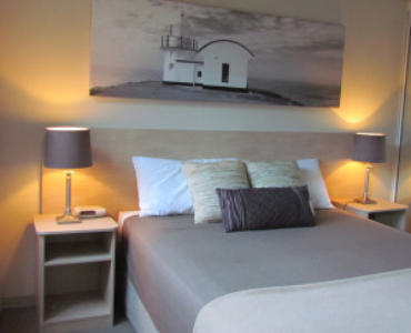
Single Bedroom Townhouses – Overnight Accommodation Port Macquarie
Looking for Overnight Accommodation Port Macquarie, or a weekend get-a-way? Shelly Beach Resort offers Standard Single Bedroom Townhouses...
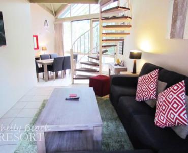
Superior Townhouse – Holiday Rentals Port Macquarie
Looking for fully self-contained Holiday Rentals Port Macquarie? The Superior Townhouse at Shelly Beach Resort is...

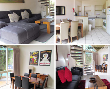
Two Bedroom Townhouses – Holiday Apartment Port Macquarie
Looking for Two Bedroom Holiday Apartment Port Macquarie? Our Standard Two Bedroom Townhouses are perfect for...
-
 The units are clean, quiet and well laid out with plenty of room for a family to relax comfortably. Kitchen is well equipped and having your own laundry was a... read more
 Kerry H
April 28, 2019 Great location rooms very clean and well presented Quite impressed by the sheer quietness of the premises located right by Shelley beach and nature reserve. Would recommend these premises to... read more  gary s
March 24, 2018